Keyboard ALT + g to toggle grid overlay
What is photogrammetry?
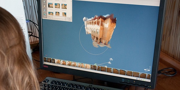
Photogrammetry is the art and science of extracting 3D information from photographs. The process involves taking overlapping photographs of an object, structure, or space, and converting them into 2D or 3D digital models.
Photogrammetry is often used by surveyors, architects, engineers, and contractors to create topographic maps, meshes, point clouds, or drawings based on the real-world.
Types of photogrammetry
There are two primary types of photogrammetry: aerial and close-range.
-
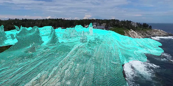
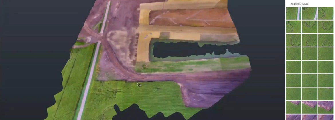
Aerial photogrammetry
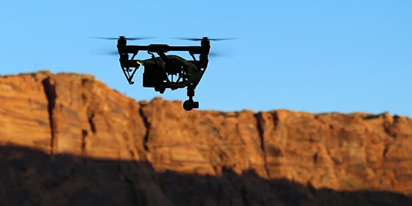
The process of utilizing aircrafts to produce aerial photography that can be turned into a 3D model or mapped digitally. Now, it is possible to do the same work with a drone. Drones have made it easier to safely capture hard-to-access or inaccessible areas where traditional surveying could be dangerous or impractical.
-
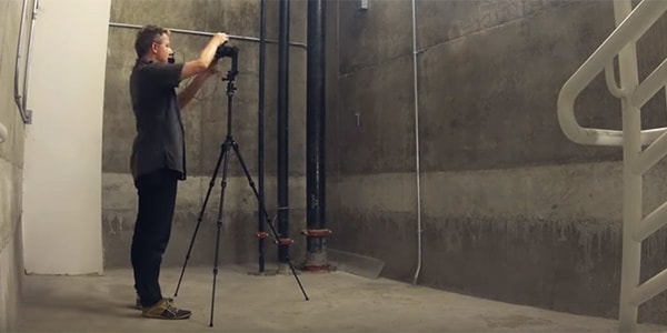
Close-range photogrammetry
Close-range photogrammetry is when images are captured using a handheld camera or with a camera mounted to a tripod. The output of this method is not to create topographic maps, but rather to make 3D models of a smaller object.
How is photogrammetry software used?
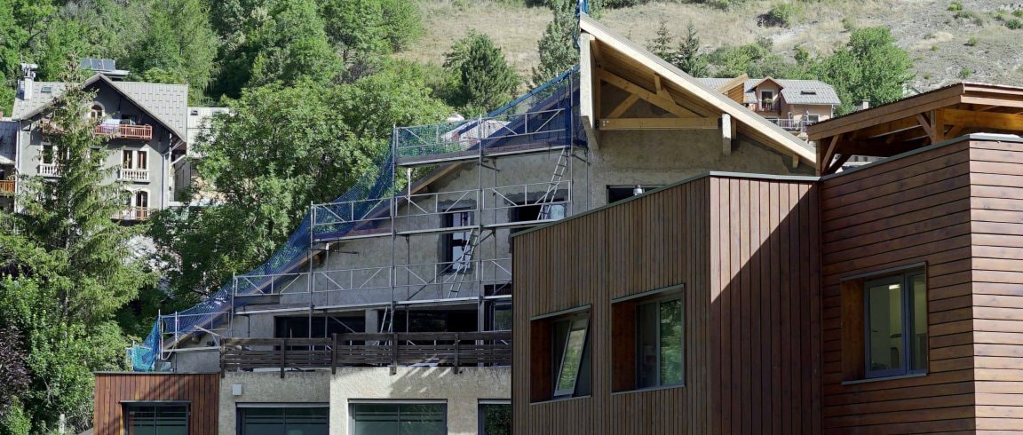
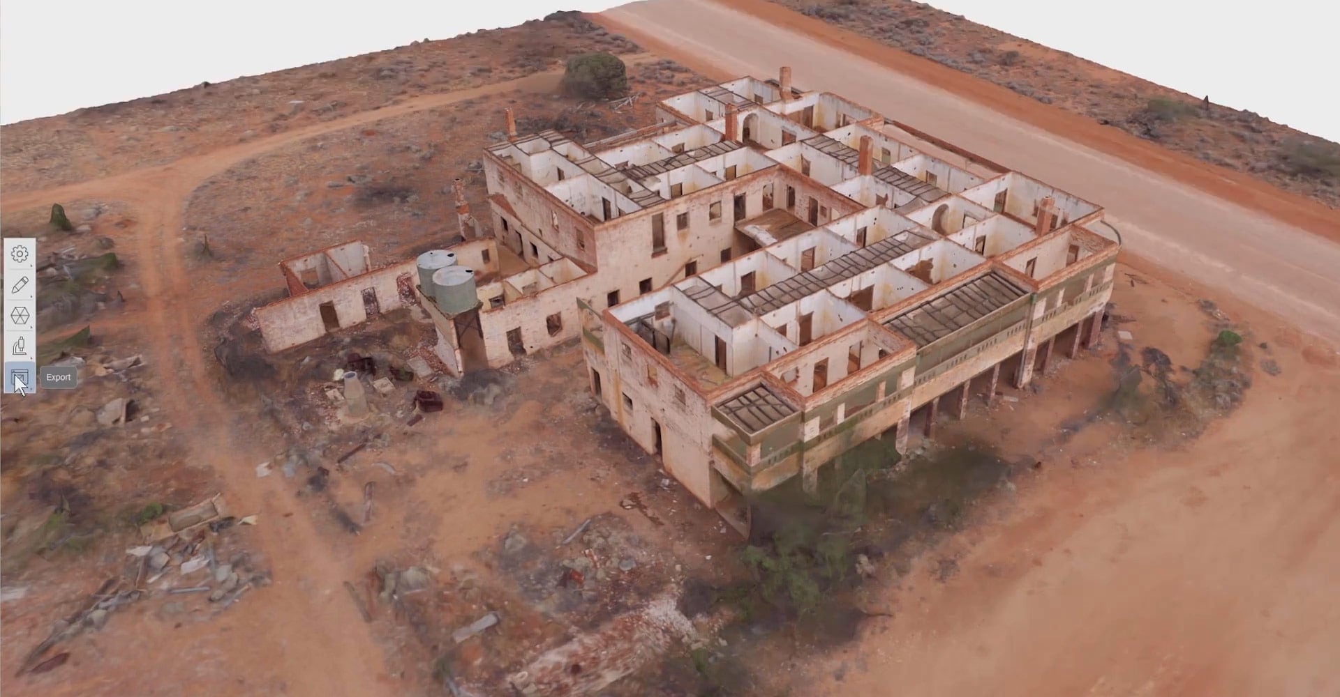
Building design and renovation
ATFF used ReCap for accurate site capture, project visualization, and BIM creation for this Aiguilles hospital renovation project.
Other applications of photogrammetry
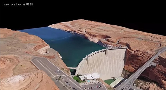
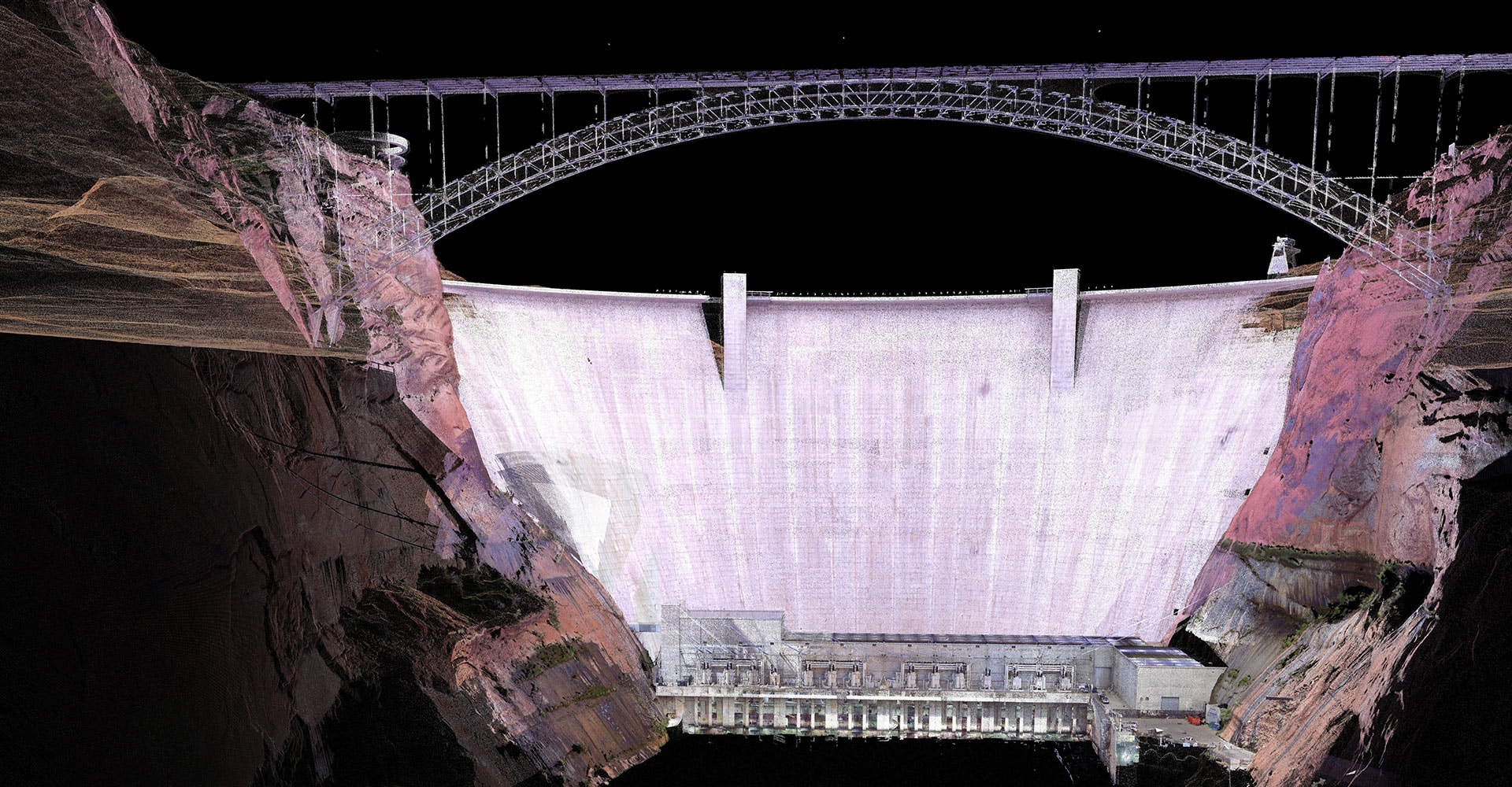
Infrastructure projects
The U.S. Bureau of Reclamation used ReCap and 3D modeling to help manage and protect the Glen Canyon Dam for generations to come.
Read story (US site)
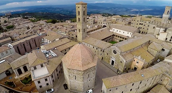
Digital preservation
Autodesk, Case Technologies, and the Volterra-Detroit Foundation scanned key historical and archaeological sites in the ancient city of Volterra in Italy.
Try ReCap Pro for 30 days
Try ReCap Pro free for 30 days and use laser scan and photo data to create 2D and 3D models. Includes ReCap Photo, our photogrammetry app built for UAV and drone processes.
ReCap Photo
ReCap Photo is our cloud-connected solution tailored for drone/UAV photo capturing workflows. Using ReCap Photo, you can create textured meshes, point clouds with geolocation, and high-resolution orthographic views with elevation maps.
Getting started with reality capture
Reality capture is the process of scanning an object, building, or site and producing a digital model.
-
Intro to reality capture
Learn what reality capture is and why adoption of it is increasing in the design and construction industry.
-

Free eBook
Download this free eBook to find out how reality capture is changing the design and construction industry.
-
Video tutorial
Learn reality capture workflows and how to integrate laser and photogrammetric scans into Revit.
-
Tips for set up
Here's a roundup of tips, tricks, and best practices for getting quality results when capturing photos.
Workflows for photogrammetry
Drone workflows with the AEC Collection
ReCap + AEC Collection
Learn about the photogrammetry workflow in ReCap and how to process photos collected from a drone. Create a funtioning TIN surface and a georeferenced orthomosaic.

Converting photogrammetry to 3D models
ReCap + Fusion 360 + Inventor
Learn how to create a model in Fusion 360 using photos processed in ReCap and complete the workflow in Inventor software.
Photogrammetry resources
Learn more about photogrammetry with these tutorials, tips, and guides.
-
Get all the latest news, reality capture technology trends, and insider resources all from one place.
-
Check out the latest reality-tech articles, submit your ideas directly to our product development team, ask us a question, or follow us on social media.
-
Autodesk University offers free, on-demand classes by topic, product, or industry.
-
Join our technical experts in this webinar series focusing on cloud-connected reality capture, 3D BIM modeling, and immersive visualization.
-
Discover techniques for taking high-quality photographs that will produce the best results for photogrammetry.
-
Drones in construction are being used to more accurately—and safely—capture valuable data from project sites.