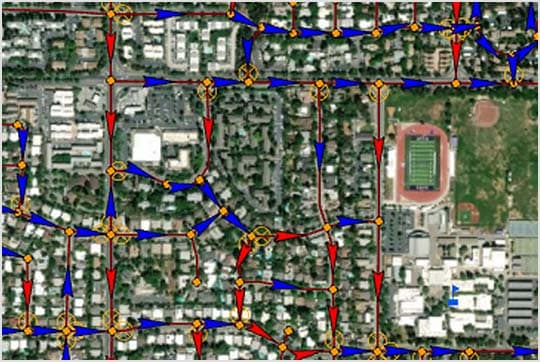
& Construction
Integrated BIM tools, including Revit, AutoCAD, and Civil 3D
& Manufacturing
Professional CAD/CAM tools built on Inventor and AutoCAD
& Entertainment
Entertainment content creation tools, including 3ds Max and Maya
Engineers use Autodesk InfoWater Pro software to model water distribution systems in an easy-to-use geographic information system (GIS) interface.
Leverage spatial analysis tools available in ArcGIS Pro to help with model building and management.
Analyse and understand criticality in your system, including pressure transient events.
Present results clearly and share them in ArcGIS Online.
Map, design, and analyse water distribution systems from within ArcGIS Pro.
Ensure adequate pressure to serve customers, even during fire flow events.
Find critical system elements and develop a contingency plan.
bLOG
Take the free InfoWater Pro course to understand how to connect to ArcGIS Pro, create a water project file, set up modelling work preferences, develop what-if scenarios to test a wide range of water system alternatives, set up steady-state and extended-period simulation runs, and review results.
TECHNICAL HUB
The InfoWater Pro Technical Information portal serves as a hub for everything you need to know about InfoWater Pro. See the latest release notes, download and licence information, help documentation, known issues, learning courses, scripting resources and public product roadmaps.
CASE STUDY
Davidson Water has seen an impressive 36% decrease in leaks over 10 years in their water network. Discover how creating a PVC pipe replacement strategy using InfoWater Pro made it happen.
Image courtesy of Davidson Water