Step-by-step guide
In ICM, coupling at bank lines connects 1D model objects to multiple 2D element faces. This can occur at either river reach banks or inline bank links, both of which are built from bank line data.
This example creates bank lines for river reach objects and builds a bank connection.
- Select Open > Open transportable database.
- Navigate to and select the .icmt file.
- Click Open.
- If a popup displays about opening the database as read-only, click Yes.
- Right-click the top-level folder and select Copy.
- In the popup, click Continue.
- In the Explorer window, right-click the Database and select Paste (with children).
- In the Copying pop-up, enable Copy ground models.
- Click Continue.
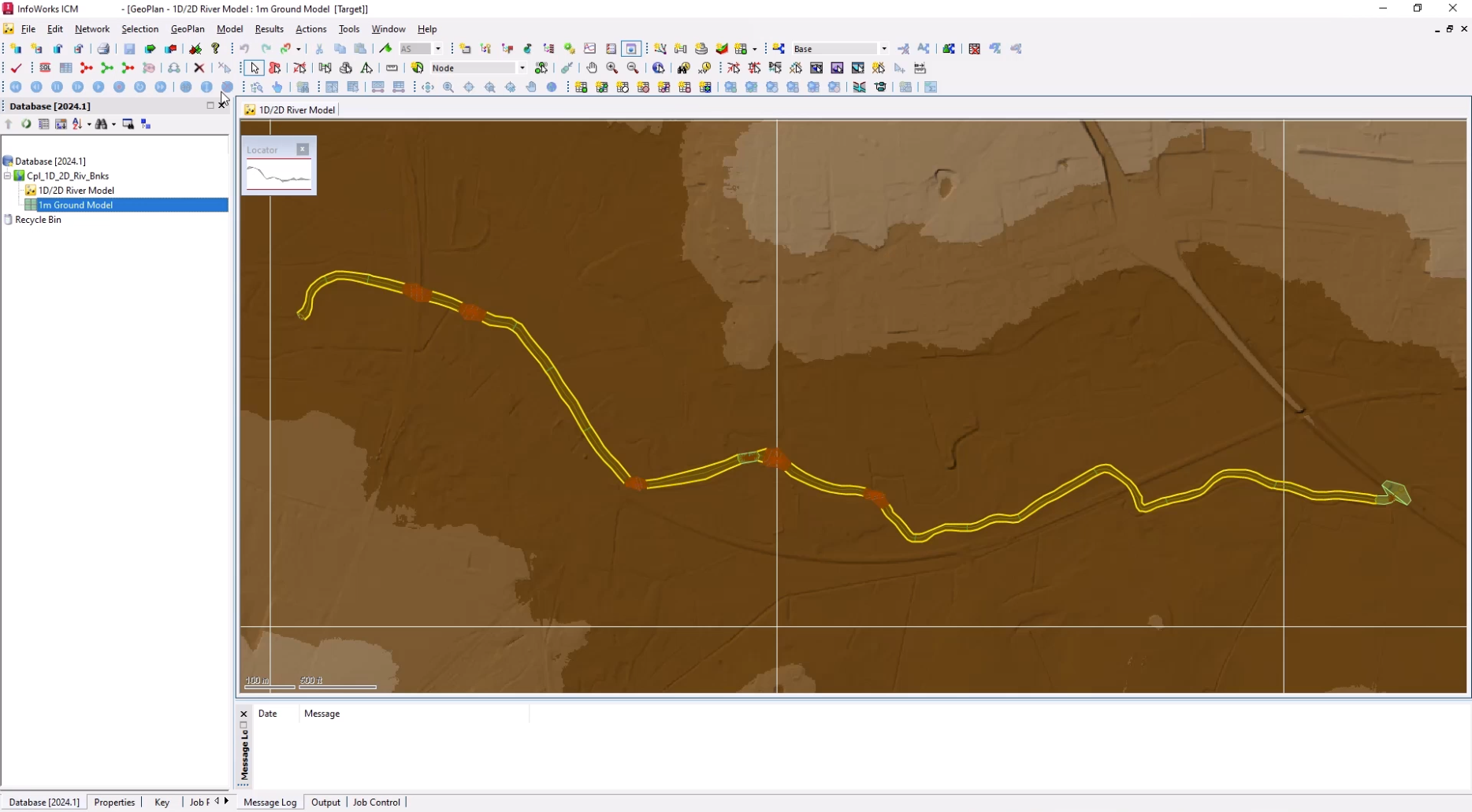
- In the Explorer window, double-click 1D/2D River Model to open it on the GeoPlan.
- From the Database, drag 1m Ground Model and drop it onto the GeoPlan.
Now, import a 2D zone:
- From the Network menu, click Import > Open Data Import Centre to open the ODIC.
- In the Table To Import Data Into drop-down, select 2D zone.
- Under Data Source, ensure the Source Type is set to Raw Shape File.
- Click the More (…) button.
- Navigate to and select the .shp file—in this example, 2D Zone.shp.
- Click Open.
- Under Field Mapping Configuration, click Auto-Map to search the import file for fields that match those defined in the network.
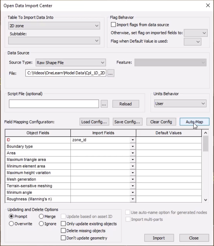
- Click Import.
An import notification reports the number of imported objects.
- Click OK to close the notification.
- Close the ODIC.
The 2D zone is imported into the model and is displayed as a green polygon.
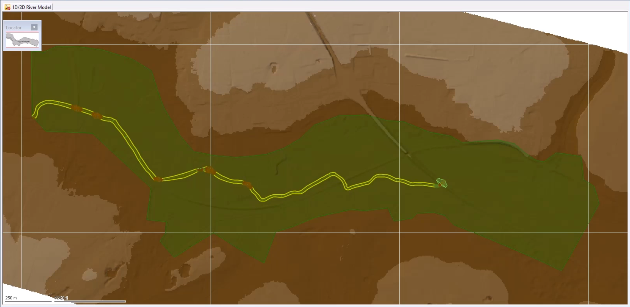
- From the GeoPlan Tools toolbar, click the Selection tool.
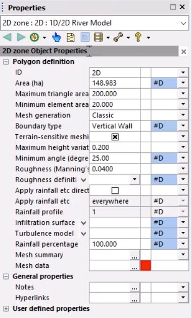
- On the GeoPlan, double-click the 2D zone to open its Properties window.
- Set the Maximum triangle area to 200.
- Set the Minimum element area to 20.
- Set the Mesh generation to Classic.
- Enable Terrain-sensitive meshing.
- Set the Maximum height variation to 0.2.
- Set the Roughness (Manning's n) to 0.04.
With these changes made, the mesh can be generated:
- Make sure the 2D Zone is still selected on the GeoPlan.
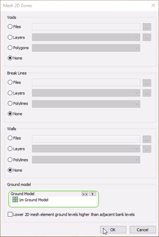
- From the Model menu, select Meshing > Mesh 2D zones.
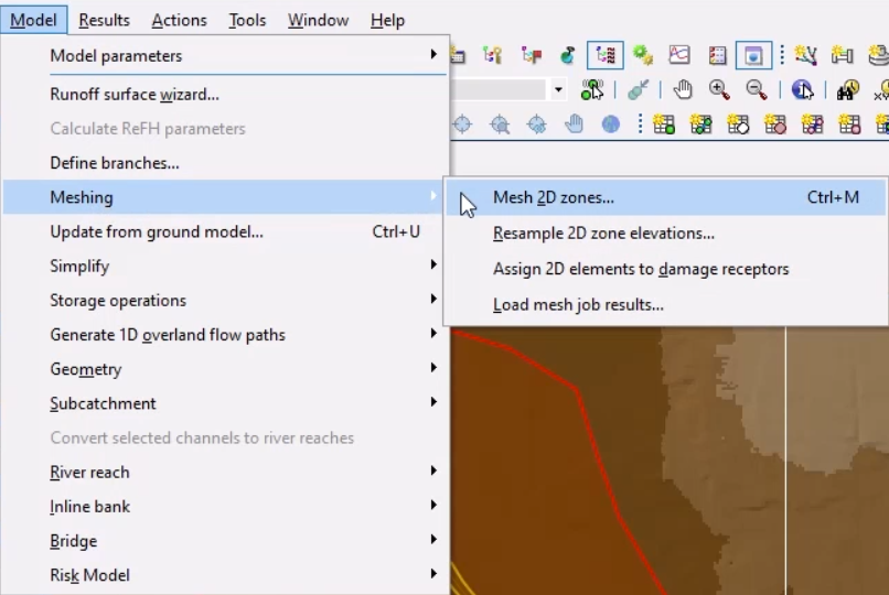
- From the Database, drag the 1m Ground Model into the Mesh 2D Zones dialog box and drop it into the Ground Model group box.
- Click OK to mesh the 2D zone.
- In the Schedule Job(s) dialog box, click OK.
- From the Window menu, select Job control window to display the status of the mesh job.
Once the mesh is complete, it can be loaded into the model.
- From the Job Control window, click the Mesh ready status to open the Manage mesh results window.
- Click Load mesh.
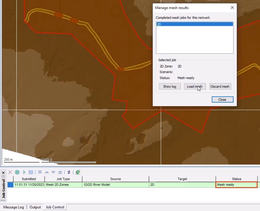
- Click Close.
- Inspect the 2D mesh to see how the terrain sensitive meshing has affected the element sizes in different areas of the model.
It may be helpful to adjust the Ground Model theme to see the mesh better.
- Right-click the GeoPlan and select Properties & themes.
- On the Layers and Themes tab, for the Ground Model object layer, in the Theme column, click Edit.
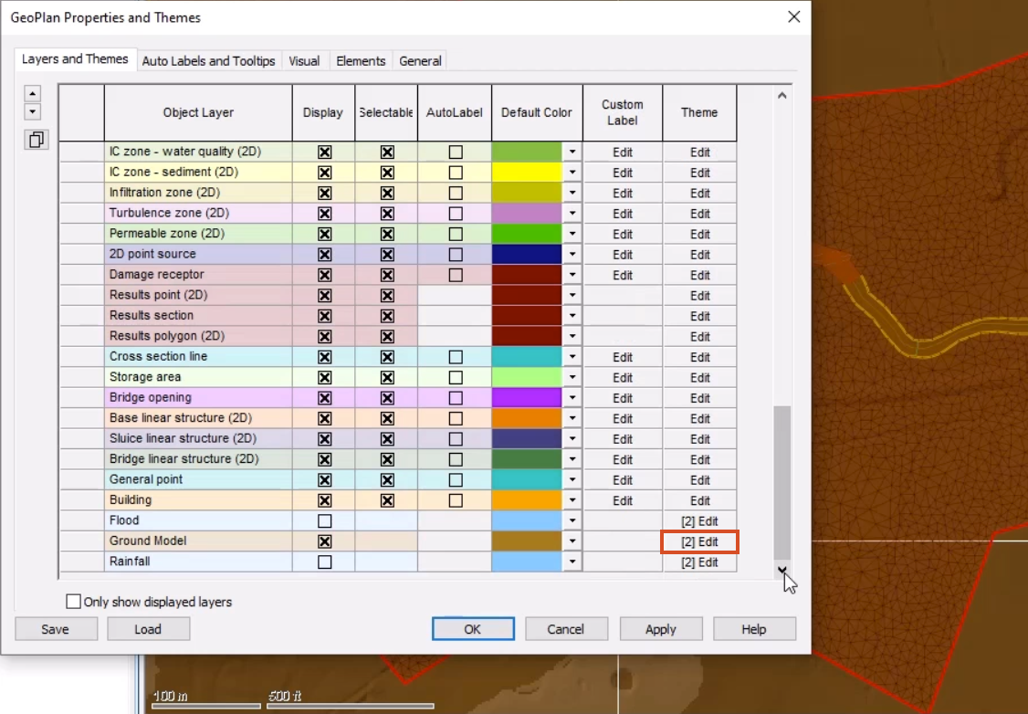
- In the Layers and Themes Editor, Map Type drop-down, select Ground Model – Transparent.
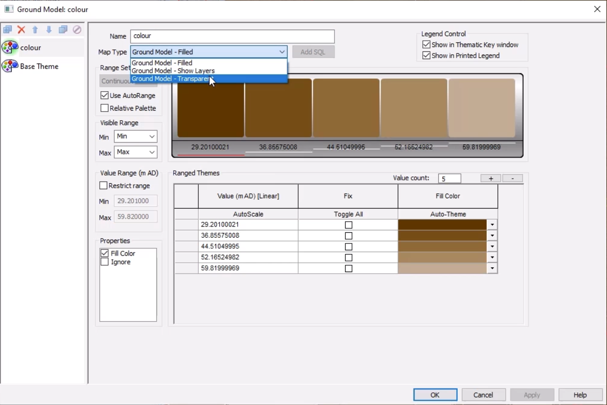
- Click OK.
- Click OK again to close the GeoPlan Properties and Themes dialog box.
Notice that the 2D zone extends beyond the river model. This is because this downstream area is complex and best represented in 2D.
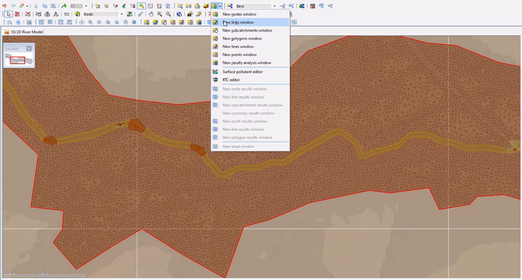
- From the Windows toolbar, expand the Grid windows drop-down and select New links window.
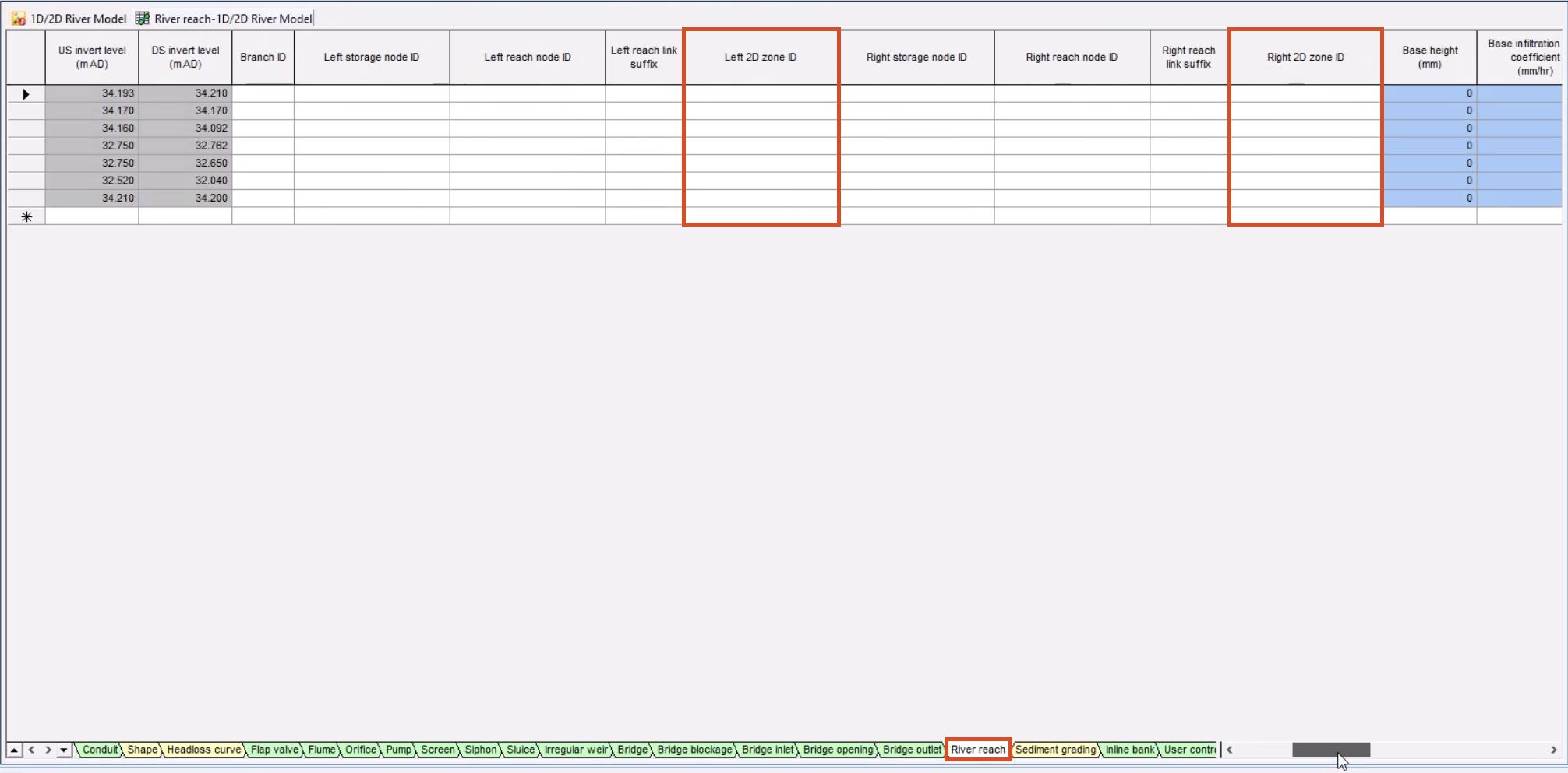
- At the bottom of the grid window, select the River reach tab to view data for the seven river reaches.
Note that the Left 2D zone ID and Right 2D zone ID columns are blank. Currently, if a simulation were run on the model, there would be no exchange of flow.
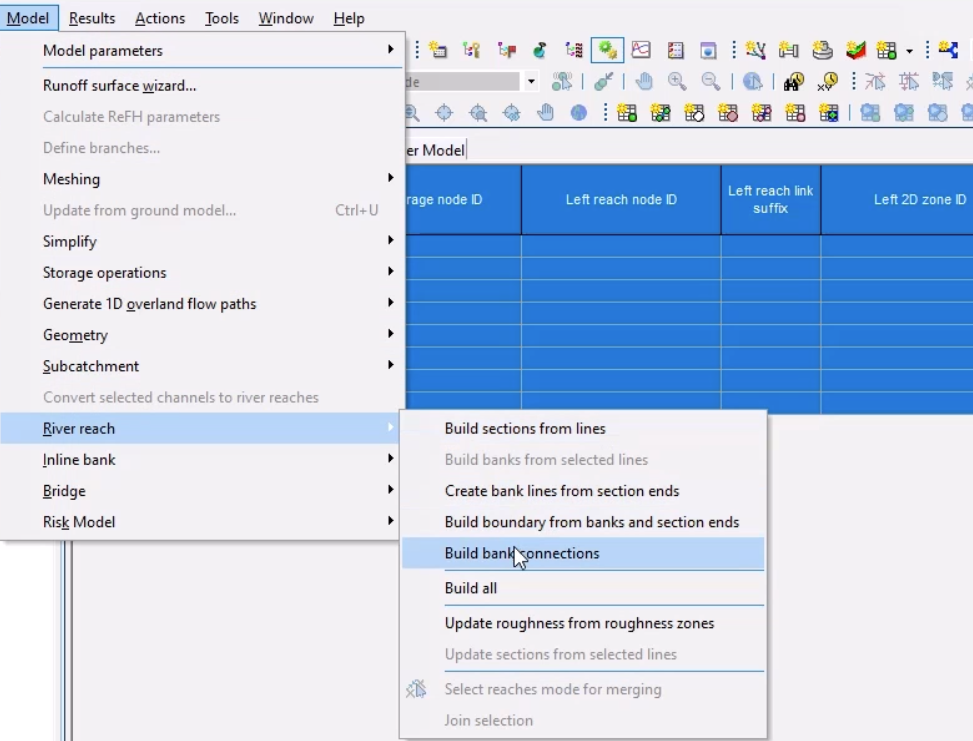
To connect the bank lines to the 2D zone:
- Click the top left of the grid to select all the river reaches.
- From the Model menu, select River reach > Build bank connections.
The Left 2D zone ID and Right 2D zone ID columns now display “2D”, the name of the 2D zone imported earlier.

- Close the grid window.
To help visualize the bank lines in the model:
- Right-click the GeoPlan and select Properties & themes.
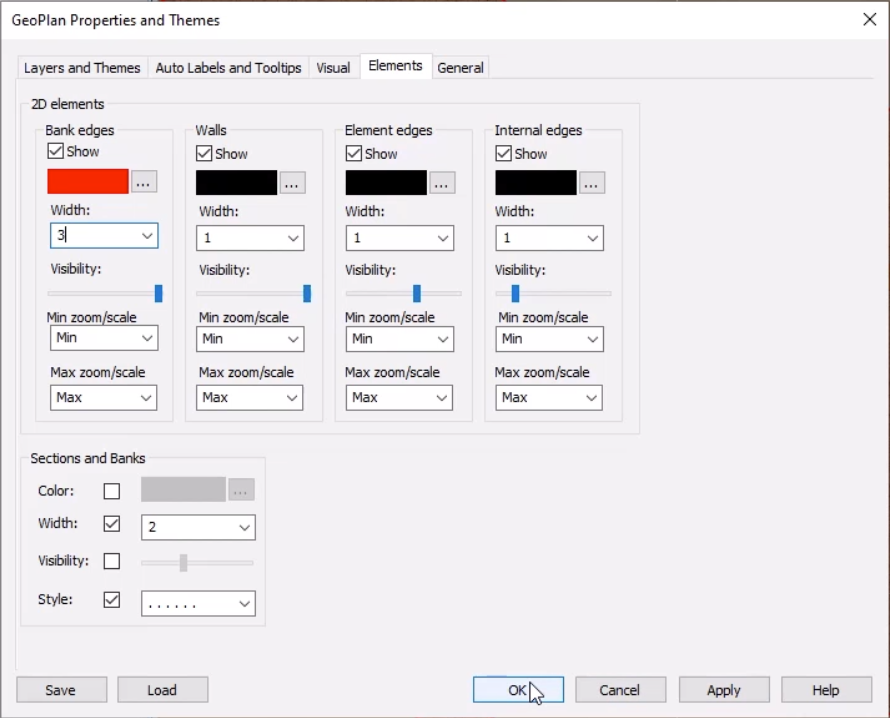
- In the GeoPlan Properties and Themes dialog box, switch to the Elements tab.
- Under 2D elements, for Bank edges, click the More (…) button.
- In the Bank Edges Color dialog box, select red.
- Click OK.
- Back on the Elements tab, set the Width to 3.
- Click OK.
At this point, there are no bank connections, as the mesh needs to be regenerated.
- With the 2D zone selected on the GeoPlan, select Model > Meshing > Mesh 2D zones.
- In the Mesh 2D Zones dialog box, click OK.
- In the Schedule Job(s) dialog box, click OK.
- Once the mesh is complete, from the Job Control window, click the Mesh ready status to open the Manage mesh results dialog box.
- Click Load mesh.
- Select Close.
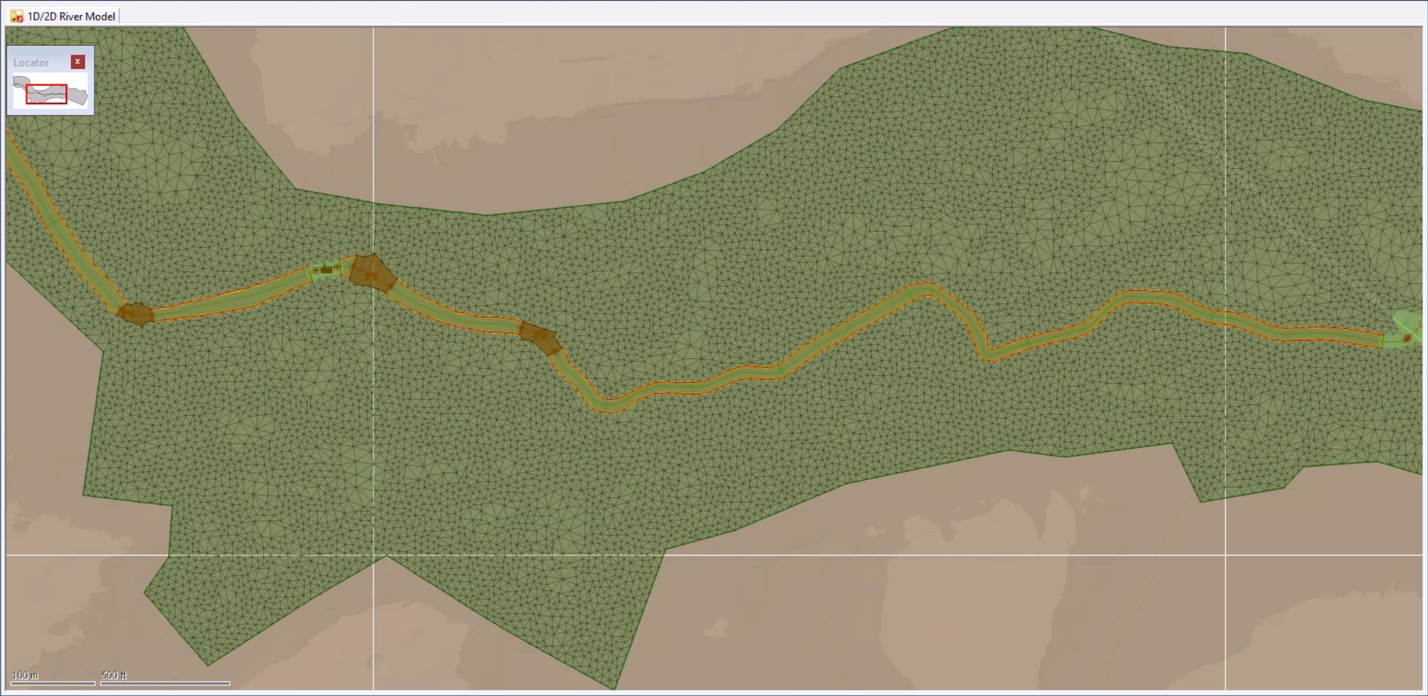
Note that the bank lines are correctly connected to the 2D zone, highlighted by the red bank edges.
- Click Validate to make sure there are no errors in the network.
- In the Network Validation dialog box, click OK.
- Click Commit changes to database to save changes.
- Add a comment, such as "Added 2D zone and connected the banks".
- Click OK.
The 1D-2D river network is now coupled along the banks.


