& Construction

Integrated BIM tools, including Revit, AutoCAD, and Civil 3D
& Manufacturing

Professional CAD/CAM tools built on Inventor and AutoCAD
Populate junction elevations using the raster elevation dataset.
Tutorial resources
These downloadable resources will be used to complete this tutorial:
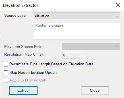
When you import a model and make manual fixes and adjustments, junctions may not have elevation data. The InfoWater Pro Elevation Extractor can be used to populate junction elevations using the raster elevation dataset.


The Junction Information table populates the DB Editor. Notice that the Elevation column is empty.

You can use the Elevation Extractor to populate the elevation information, but be aware that this tool only accepts raster files.


The Elevation Extractor takes the value of the pixel corresponding to each junction and assigns it in the Elevation field of the InfoWater Pro Information Database Table.

You can see that elevation data is now contained in the database table:
