What is Autodesk Civil 3D?
Civil 3D enables civil engineers with precision design tools built to meet complex infrastructure challenges in a 3D model-based environment.
Accelerate design and documentation to meet project requirements
Enable advanced automation and analysis tools
Connect project teams to improve collaboration and coordination
INTEGRATED WORKFLOWS
Analyze, iterate, and refine designs
CONTEXTUAL DATA
Gain efficiencies with seamless GIS Integration
COLLABORATION & DATA MANAGEMENT
Improve project collaboration
AUTODESK ASSISTANT (TECH PREVIEW)
Access AI-powered support in Civil 3D
INTEGRATED WORKFLOWS
Analyze, iterate, and refine designs
CONTEXTUAL DATA
Gain efficiencies with seamless GIS Integration
COLLABORATION & DATA MANAGEMENT
Improve project collaboration
AUTODESK ASSISTANT (TECH PREVIEW)
Access AI-powered support in Civil 3D
Features to support your operations

Site and survey workflows
Download, create, analyze, and adjust survey data, as well as transfer field-captured data to the office.

Terrain modeling
Create digital models of topography for land-use studies, transportation system planning, and water flow simulations.
Corridor modeling
Create dynamic and data-rich corridor models for highways, roads, and rail tracks.

Design automation
Use visual programming to generate scripts that automate repetitive and complex tasks, including electrification and signaling.

Drainage design and analysis
Manage stormwater and sanitary sewer design. Define pipeline paths, optimized with hydraulics/hydrology analysis.

Materials and quantities
Use materials and sectional or profile information to create reports for volumes, comparing design and existing surfaces and quantity takeoff.

NEW
Forma Data Management Essentials
Included with standalone Civil 3D subscriptions, Autodesk Forma Data Management Essentials centralizes cloud-based project data.

ENHANCED
Autodesk Assistant
Access AI-generated support and solutions in Civil 3D and troubleshoot your design challenges without leaving the workspace.

ENHANCED
Autodesk AI
Whether you're planning, concepting, or analyzing, Autodesk AI supports your process at every stage of the AECO lifecycle.
Civil infrastructure workflows
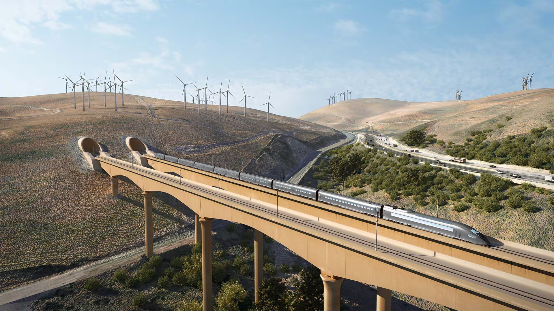
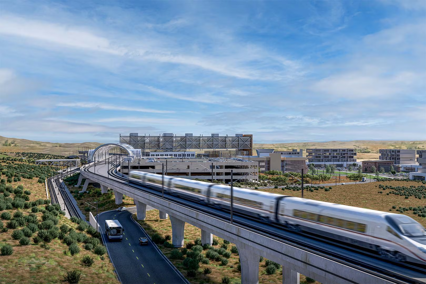
Civil 3D for rail design
Accelerate planning, design, and delivery of transit stations and rail networks.
Accelerate planning, design, and delivery of transit stations and rail networks.
"The precision of Civil 3D allowed the team to create an accurate representation of the underground soil, ensuring enough material was available on-site."
"[With Autodesk] we're able to collaborate seamlessly using the AEC package on our BIM platform."
"The benefits are about transparency and better collaboration."
Design better, smarter, faster with the AEC Collection
Design better, smarter, faster with the AEC Collection
Save over annual licenses
Explore a powerful set of tools with extended capabilities built for engineering complex products, equipment, and systems.
Explore a powerful set of tools with extended capabilities built for engineering complex products, equipment, and systems.
Products included
+ 11 more
Design better, smarter, faster with the AEC Collection
Design better, smarter, faster with the AEC Collection
Save over annual licenses
Explore a powerful set of tools with extended capabilities built for engineering complex products, equipment, and systems.
Explore a powerful set of tools with extended capabilities built for engineering complex products, equipment, and systems.
Products included
+ 11 more
Civil 3D resources & community
Webinar
What’s new in Civil 3D 2027
Deep dive into the powerful capabilities for infrastructure design workflows.

Blog
Civil 3D highlights and updates
See the latest updates for efficiently designing and digitally modeling infrastructure projects.
PRODUCT ROADMAP
What’s next in Civil 3D
Explore the product development pipeline for Civil 3D and provide your feedback.

AUTODESK UNIVERSITY
Learn advanced civil workflows from your peers
Discover new approaches for better infrastructure with these resources from Autodesk University.

COMMUNITY FORUM
Connect with the Autodesk Community
Ask questions, share your knowledge, or submit product ideas.

AUTODESK LEARNING
Get started on your own Autodesk learning path
On-demand e-learning resources to sharpen your skills, enhance your career, and demonstrate knowledge.

AUTODESK CERTIFICATION
Show off your skills
Validate design and make skills to get hired, advance your career, and accelerate your business.


Questions? We have answers.
Autodesk Civil 3D is civil engineering computer-aided design (CAD) software used to plan, design, and deliver land development, water, and transportation infrastructure projects. It includes features to automate tasks and increase productivity such as comparing drawings, grading surfaces, modeling rail and highway corridors, analyzing drainage systems, and producing documentation in a model-based environment.
Civil engineers, civil designers, and infrastructure professionals, including those working in transportation, land development, and water projects, use Autodesk Civil 3D to efficiently design, analyze, and document complex civil infrastructure projects.
Your Autodesk Civil 3D subscription gives you access to install and use the 3 previous versions. Available downloads are listed in your Autodesk Account after subscribing. See also previous releases available for subscribers.
Products you can trust
From payment flexibility to always-on support, expect excellence.


