& Construction

Integrated BIM tools, including Revit, AutoCAD, and Civil 3D
& Manufacturing

Professional CAD/CAM tools built on Inventor and AutoCAD
Explore new and enhanced features of InfoWorks ICM 2026, including new sewer and flood offerings.
Gain access to a comprehensive and easy-to-use system for fully integrated catchment modeling
Run powerful simulations in the cloud or locally, delivering speed and efficiency improvements
Model complete drainage systems including sewers, surface water, rivers, and floodplains
Share model data among a workgroup of users with audit trails and security mechanisms
Create and edit multiple scenarios in parallel with the ability to easily edit and modify
Quickly and easily import model data from other systems and automatically check for errors
Analyze simulation results using a variety of graphical outputs, including 3D, textual, and statistical outputs
Run simulations with the hydraulic engine, and even use the SWMM5 engine if desired
Export network designs into InfoWorks ICM, simulate and make changes, then transfer back to Civil 3D
Run models on historical databases to ensure accurate model results in line with regulatory compliance
Ensure non-technical and supervisory stakeholders can access models with the free InfoWorks ICM Viewer
Flexible usage options for sewer and flood modelers with InfoWorks ICM Sewer and InfoWorks ICM Flood
Get the latest integrated catchment modeling software. Model simple to complex hydraulic and hydrologic network elements quickly and accurately locally or in the cloud. Make capital planning decisions, model system expansions, and plan for emergency scenarios.
NEW
Subgrid Sampling
You now have the option to use larger mesh elements in your model while still capturing highly accurate and detailed topographical changes in your surface, leading to faster and more accurate simulations.
NEW
2D mesh histograms
Easily identify any 2D mesh element areas that are smaller than the specified minimum element size, making the model troubleshooting process more efficient.
NEW
RPA report export to Info360
While running RPA reports, easily understand how a drainage system will perform under various rainfall conditions in relation to asset management data. (video: 2:21 min.)
NEW
InfoWorks ICM Viewer
You can now view model data and analyze existing results in InfoWorks ICM using the new Autodesk InfoWorks ICM Viewer. You do not need an Autodesk licence to use it, but you will need an Autodesk account.
NEW
Copying cloud simulation results
You can now copy simulation results from a run in a cloud database whose full results have been downloaded, to a transportable database version 2024.5 or newer. This lets you share the results between cloud and on-premise databases, or with other users, by copying the results from the transportable to an on-premise database.
CNSWMM infiltration for 2D simulations
A new infiltration model, CNSWMM, combines the CNSWMM curve number model with initial losses.
Cloud enhancements
InfoWorks ICM users can now access results faster than ever with direct access to cloud simulation results. Interrogate and export some cloud results without downloading the full time-series results. Scalar and spatial time series data (TSD) objects are now available in cloud databases.
Concurrent installation
InfoWorks ICM 2026 brings more flexibility to how you work. Users now have the flexibility to install Innovyze and Autodesk versions of software, including ICMLive and InfoAsset Manager.
2D culvert modeling
A new conduit option, Culvert 2D, enables users to link 2D culverts to multiple mesh elements inside a model, providing a more robust 2D option for representing culverts in a floodplain.
Civil 3D integration
Civil 3D designers can now easily share designs with hydraulic modelers. Export a sanitary and storm sewer pipe network into InfoWorks ICM, run simulations on the network model, and make adjustments where needed. Then, transfer these changes back to the model in Civil 3D for a streamlined planning and design process.
XP Importer
You can now move an existing XPSWMM model into InfoWorks ICM in a matter of a few clicks with our XP Importer.
FEH2022 design rainfall events
A new design rainfall generator, FEH2022, allows users to download rainfall data as XML files from the Flood Estimation Handbook web service, and import them into InfoWorks ICM using the Rainfall Generator dialog.
SWMM engine
The SWMM networks now have the option to use the latest 5.2.2 engine (for databases 2024.0 and above).
River bankline creation
Efficiently create river banklines from end sections by truly following the centerline.
Workgroup model management
Teams can work together in a shared space to create unified models that are complete and accurate.
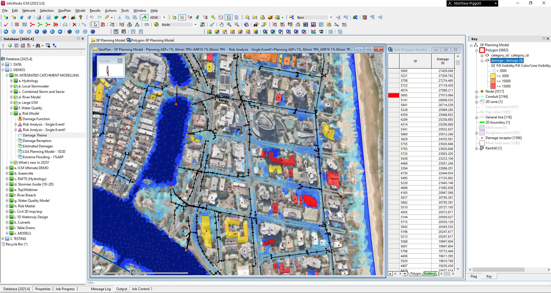
Integrated 1D and 2D modeling
Model 1D hydrodynamic simulations and 2D simulations in urban environments and river floodplains.
Powerful hydraulic simulation
Fast, robust, stable, and efficient dynamic simulation engine offers accurate representation.
Prepare for events
Address sanitary sewer overflows and combined sewer overflows through emergency storm simulations.
Live operational support
InfoWorks ICM allows any live data to be used within the background of a comprehensive utility network model.
Data inferencing
Run models accurately with built-in inferencing tools that fill in missing elements from raw survey data.
SQL and other scripts
SQL queries and Ruby Scripts automate processes such as creating new scenarios, saving you time.
GPU utilization
Using GPUs can speed up simulations 12 times or more with large models.
RAFTS hydrology
The RAFTS Australian hydraulic routing method links directly with the ARR data hub and Australian BOM.
