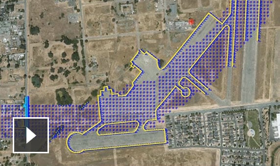
Download, create, analyze, and adjust survey data. Streamline the transfer of field-captured data to the office. (video: 16 sec.)
CIVIL 3D FOR ROAD AND HIGHWAY DESIGN
Deliver optimized designs and documentation
Accelerate design, optimization, and documentation of road network and bridge projects. Work with an intelligent model-based approach for surface and corridor modeling, drainage layout, and plans production.
Road design
What you can do with Civil 3D
-
-
![Video: Silent screencast that shows a roadway model and driving simulation in Civil 3D user interface]()
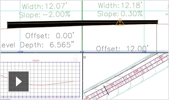
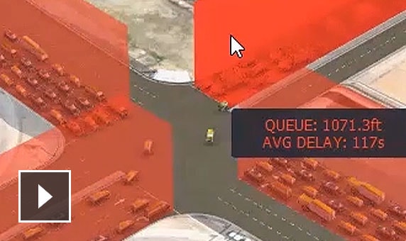
Corridor modeling
Create dynamic, flexible 3D models of road corridors. Simulate driving through the corridor and visually evaluate sight distance and influence analysis. (video: 35 sec.)
-
![Video: Silent screencast showing a wireframe of a 4-way intersection from different angles]()
Intersection design
Create dynamic models of 3-way (T-shaped) or 4-way intersections. Model roundabouts according to standards that blend with existing or planned roads. (video: 10 sec.)
-
![Video: Silent screencast that shows draining options for a roadway model in Civil 3D 2021]()
Drainage design
Perform storm water management tasks, including storm sewer design. Define pipeline paths, optimized with hydraulics/hydrology analysis. (video: 10 sec.)
-
![Video: Silent screencast that shows some of the road rehab tools in Civil 3D]()
Road rehabilitation
Automate assembly generation for your rehab corridor design model. Optimize mill and overlay to balance costs vs. performance. (video: 57 sec.)
-
![Video: Expedite project delivery and enhance quality with Dynamo for Civil 3D 2021]()
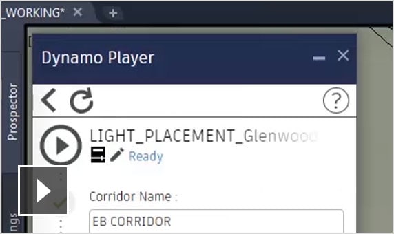
Design automation
Use visual programming to generate re-usable scripts that automate repetitive and complex tasks. (video: 1:28 min.)
-
![Video: Silent screencast that shows a roadway volume report being generated in Civil 3D]()
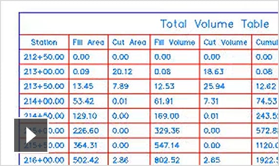
Materials and quantities
Use materials information to create reports for volumes along an alignment, comparing design and existing ground surfaces, and quantity takeoff. (video: 20 sec.)
-
![Video: Silent screencast showing tools for creating plan production sheets for a road in Civil 3D]()
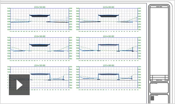
Plan production and documentation
Create plan production sheets that automatically display station ranges of alignments and profiles that are based on predefined areas along an alignment. (video: 24 sec.)
Workflows
Connect other Autodesk products for road network design.
-
![Video: Tools in the AEC Collection let you create accurate road and highway models with greater detail]()
Civil 3D + ReCap Pro + InfraWorks + Dynamo
Create conceptual design in-context, complete detailed design, and automate repetitive tasks. (video: 2:42 min.)
-
![Video: The AEC Collection has an integrated bridge design workflow that lets you rapidly develop multiple design options]()
Civil 3D + InfraWorks + Revit
Use parametric modeling tools to better coordinate multidiscipline teams on bridge projects. (video: 2:56 min.)
See how people are using Civil 3D for road design
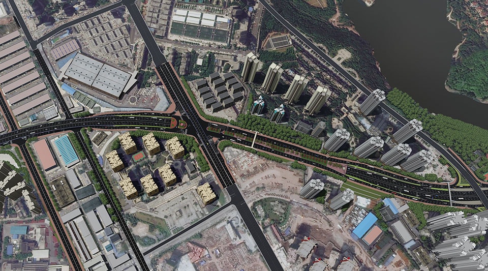
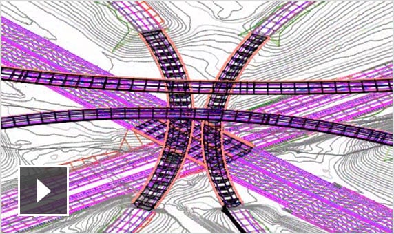
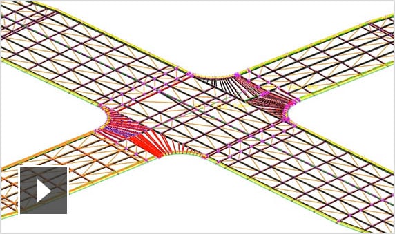
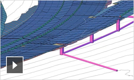
CHONGQING ARCHITECTURAL DESIGN INSTITUTE (CQADI)
Speeding up a complex interchange project
BIM helps deliver a multi-layered solution to a major highway reconstruction project in China.
Image courtesy of Chongqing Architectural Design Institute of China